Lesson 09 — Rivers, Oceans, Deserts, Mountains
Learners explain how geography — rivers, oceans, deserts, and mountains — both connected and separated peoples. They trace the Silk Roads across deserts and mountains, Indian Ocean sailing shaped by monsoon winds, rivers that fed and linked civilizations, and the Sahara crossed by caravans, and see that every barrier could also be a bridge for ideas and goods.
Objectives
Objectives
- D08.S3.07.02 Explain how geography, such as rivers, oceans, deserts, and mountains, helped connect or separate peoples and shaped the spread of ideas and goods.
Essential question
How did geography — rivers, oceans, deserts, and mountains — connect and separate peoples, and shape the spread of ideas and goods?
Key vocabulary
Materials
Standard materials
- Landform-and-route map · 1 per learner A simple map with rivers, an ocean, a desert, and mountains, plus trade routes to trace
- Connect-or-separate cards · 1 set per pair Cards naming landforms and what moved across them (silk, spices, ideas, crops) to sort as bridge or barrier
Low-tech / no-cost
- Voice and a drawn map in sand Draw the landforms in soil and trace the routes with a stick — no printed map needed
- Found objects as landforms Use stones as mountains, a cloth as desert, a water line as river, and act out a journey
Enriched / lab & device
- A physical or digital world map · 1 A map to locate the Silk Roads, the Indian Ocean, the Sahara, and major rivers
- A short film on the Silk Roads or Indian Ocean trade · 1 A clip showing how geography shaped the movement of goods and ideas
Works in different contexts
- large-group Trace the routes on a big map as a class, adding what moved (goods, ideas) at each landform
- multi-age Younger learners sort bridge vs. barrier; older learners explain how one landform both connected and separated at once (a desert as both wall and caravan road)
- self-directed A learner traces the routes on the map and writes why one landform both connects and separates
- level-grouped Learners ready to extend explain how monsoon winds made Indian Ocean sailing seasonal and shaped when and where people traded
- outdoor-only Use found objects and bodies to model mountains, desert, river, and ocean, and walk a trade route across them
Lesson 9 — Rivers, Oceans, Deserts, Mountains
Summary
Learners explain how geography — rivers, oceans, deserts, and mountains — both connected and separated peoples. They trace the Silk Roads across deserts and mountains, Indian Ocean sailing shaped by monsoon winds, rivers that fed and linked civilizations, and the Sahara crossed by caravans, and see that every barrier could also be a bridge for ideas and goods.
Objectives
- Explain how geography — rivers, oceans, deserts, and mountains — helped connect or separate peoples and shaped the spread of ideas and goods. (D08.S3.07.02)
Connection
Look at where you live. Is there a river, a sea, a mountain, a stretch of open land between you and the next town? That land shapes who you meet, what you eat, what you buy, and what ideas reach you. A mountain can cut two valleys off from each other — or a pass can join them. A desert can be a wall — or a road for those who know its oases. The same Earth feature can separate and connect at once. That is the story of every civilization: geography is never just a backdrop; it is a player in the human story.
Materials
- Landform-and-route map
- Connect-or-separate cards
Preparation
- Copy the map and cards.
- Retrieval: recall from Lesson 4 how paper moved along trade routes; today we zoom out to why routes run where they do — geography.
Facilitator note
This lesson is written to the learner (“you”). The ideas to land: (1) rivers fed early civilizations and served as highways (the Nile, the Niger, the Ganges, the Indus); (2) oceans connected distant peoples — the Indian Ocean’s monsoon winds made seasonal sailing possible, linking East Africa, Arabia, India, and Southeast Asia; (3) deserts could separate (the Sahara) but also be crossed by camel caravans carrying salt and gold; (4) mountains could divide (the Andes, the Himalayas) but passes and road systems (the Inka roads) linked their peoples; (5) the Silk Roads — a network of overland routes across deserts and mountains — carried silk, spices, paper, and ideas like Buddhism and numerals between East Asia and the Mediterranean. These are established geographic-historical facts (see UNESCO’s Silk Roads project and Encyclopaedia Britannica, “Silk Road” and “Indian Ocean trade”). Model tracing one route explicitly, then let learners trace and sort (Kirschner, Sweller & Clark, 2006). The environment lens: geography is the living Earth shaping human life, and humans shaping it back. The global lens: this is a world map with many centers — no single route or region is the default. The egalitarian lens: trade connected peoples as roughly equal partners; it also, at times, carried conquest — and noting who benefited and who did not keeps the story honest. The technology lens: the ship, the camel saddle, the road, the pass — technology is how people turned barriers into bridges.
Procedure
- Gather (5 min). Quick recall: what is the difference between voluntary and forced migration? (One is chosen, one is not.) Today: the land itself — how it joins and divides people.
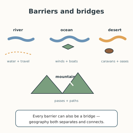
- Meet the landforms (10 min). Rivers feed and carry (the Nile, Niger, Ganges, Indus). Oceans connect across vast distances. Deserts wall people off — and are crossed by caravans. Mountains divide — and their passes join.
- Trace the routes (15 min). On your map, trace the Silk Roads — overland routes across deserts and mountains carrying silk, spices, paper, and ideas (like Buddhism and the numerals) between East Asia and the Mediterranean. Then trace the Indian Ocean, where monsoon winds let sailors cross seasonally, linking East Africa, Arabia, India, and Southeast Asia.
- Sort bridge or barrier (10 min). With a partner, sort the connect-or-separate cards: for each landform, was it a bridge, a barrier — or, often, both?
- Close (10 min). Every barrier can be a bridge, and every bridge can be crossed by more than goods — by ideas, faiths, and numbers. Geography shapes the human story, and humans shape it back.
Differentiation
- Support: Use only the bridge-or-barrier sort with two starter labels and one sentence per landform.
- Extension: Explain how monsoon winds made Indian Ocean sailing seasonal — and how that shaped when people traveled and traded, not just where.
Assessment
- Formative (observation/self): Can the learner name one way a river, an ocean, a desert, and a mountain each connected and/or separated peoples, and one idea or good that moved along a route?
- Self-check: The learner asks, “Did I explain how one landform can both connect and separate, and did I name what actually moved along the routes?”
Home connection
Look at the land between your home and the next place people gather — a river, a road, a hill, open land. Ask someone older how that land has shaped where people go, what they buy, and who they meet.
Resources
- The roles of rivers (Nile, Niger, Ganges, Indus), Indian Ocean monsoon sailing, the Sahara’s caravan trade, and the Silk Roads in connecting and separating peoples are standard geographic-historical facts (see UNESCO’s Silk Roads project, en.unesco.org/silkroad, and Encyclopaedia Britannica, “Silk Road” and “Indian Ocean trade”). The Inka road system across the Andes is likewise documented. The claim that trade sometimes carried conquest and unequal benefit is a fairness framing, not a geographic finding.
- On explicit instruction and worked examples: Kirschner, Sweller & Clark (2006), https://doi.org/10.1207/s15326985ep4102_1